Protecting the Green Triangle: experts warn of ‘irreversible’ groundwater decline | Rural Australia

Some of the best-quality groundwater in Australia underlies the upper and lower south-east of South Australia and parts of south-western Victoria.
But almost 200 years of draw down for agriculture, farming and domestic use has changed the surface drainage. Underground water in some areas has collapsed and water quality is deteriorating, putting at risk not only a fragile natural ecosystem but a $5bn regional economy.
Some of the biggest declines are close to commercial forestry plantations, particularly blue gum plantations, where monitoring by the SA department of environment shows water table declines of several metres.
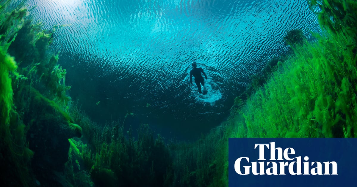
The latest alarm sounded in 2023 when a big algal bloom polluted Piccaninnie Ponds in South Australia, likely caused by low water levels and high nutrient loads.
Staff from that state’s National Parks and Wildlife Service working in kayaks rounded up an estimated 10 tonnes of algal sludge and closed the ponds to snorkelling and diving.
The famous cave-diving site, known for its crystal-clear waters and aquatic plants, is a Ramsar-declared wetland of international significance, a conservation park and a rare Australian example of a karst rising-spring wetland, fed largely by groundwater inflows.
Discharge of water from the rising-spring system, that would either be drained, used for stock watering or remain as a surface wetland, is also declining.
In 2022, the discharge was the lowest on record.
SA lieutenant governor and cave diver Dr Richard Harris described what he saw after a dive at Piccaninnie as “dreadful” and said he feared for the future of the ponds.
“I am worried that what is happening at Piccaninnie Ponds and the recent dropping in levels in Ewens Ponds could potentially represent a tipping point, one of these moments where if it actually spirals out of control we could be facing a local disaster,” he told the SE Voice.
Ewens Ponds, another renowned dive spot nearby, closed this year because of a reported 50cm plunge in water levels. Both Piccaninne and Ewens Ponds remain closed.
Signs of aquifer stress have been reported for decades but the unusually dry year has reinforced the urgency.
Fourteen years ago, a lower limestone coast taskforce reported drops in the water table over the “past five to 10 years” and warned the region could be “reaching the limits of sustainable water use”.
In the north of the region, blue gum plantations have been blamed for a 6-metre decline in underground water levels.
Big falls present another threat: increased salinity.
SA’s second biggest city, Mount Gambier, and the Coonawarra wine region rely on underground water, as do countless other small towns and farms.
The south-east is the biggest user of underground water in the state. There is no more water available for allocation in the managed areas, according to the lower limestone coast water allocation plan.
Independent conservation ecologist Claire Harding, who has consulted with NPWS, said few aspects of the ponds hydrology were monitored.
“As site managers the NPWS has limited ability to manage the issues around water quality and quantity at Piccaninnie Ponds that are likely caused by landscape-scale pressures,” she said after the ponds’ closure.
Big dairy, irrigated crops, mining, improved pasture operations and forestry surround the ponds.
Harding said all these industries occur at a higher elevation to the ponds, with groundwater flow in the direction of the ponds.
“I am not aware of any systematic monitoring of agricultural pollutants, either runoff or groundwater, in this area.”
The SA Department of Environment and Water (DEW) said it believes reduced inflows and high nutrient levels “partially” caused the bloom and it will “undertake further investigation”.
SA’s Environment Protection Agency, responsible for nutrient testing, did not respond to questions.
Over the next three years, Landscape South Australia (Limestone Coast) is revising its 2013 water allocation plan.
Planning and development manager Liz Perkins said while the impact of continued water taking was accepted, declines in groundwater “are not an acceptable impact”.
Acceptable effects are yet to be refined, she said.
Perkins said the effects of long-term use of groundwater could be “irreversible”.
“In places where groundwater levels have declined and recharge reduced, recovery may not be possible,” she said.
Wetlands once covered 44% of the south-east. Drainage of agricultural properties – there are about 2,500km of drains in the region – and land clearing reduced wetlands to just 6% of the surface.
In the process, a clay lining – the natural seal that retained water recharge and maintained levels – was broken.
The Green Triangle, the highly productive area that covers south-west Victoria and south-east South Australia, contains 17% of Australia’s forestry plantations, covering about 328,000 hectares as of 2020.
The industry, a top three employer in the south-east, faces changes in how SA regulates water allocations using a framework that guides adjustments to achieve the necessary outcomes.
At public information sessions for the water allocation plan review, questions were asked about how forestry and other industries with permanent plantings would handle lower water allocations if that is what the framework recommends.
South Australian Forest Products Association wants water drained to the sea returned to the land. Its chief executive officer, Nathan Pine, said their plantation estates “have shrunk over the past decade with around 30,000 hectares lost due to environmental and water policy that has stopped the replanting of trees in core forestry areas”.
It wants to ensure every tree harvested is replanted so plantations can increase.
Source link


